The weather is warm and sunny; all the snow has melted … it’s the perfect time to work on the bucket list of hikes in the Kootenays that I want to do!
Fisher Peak
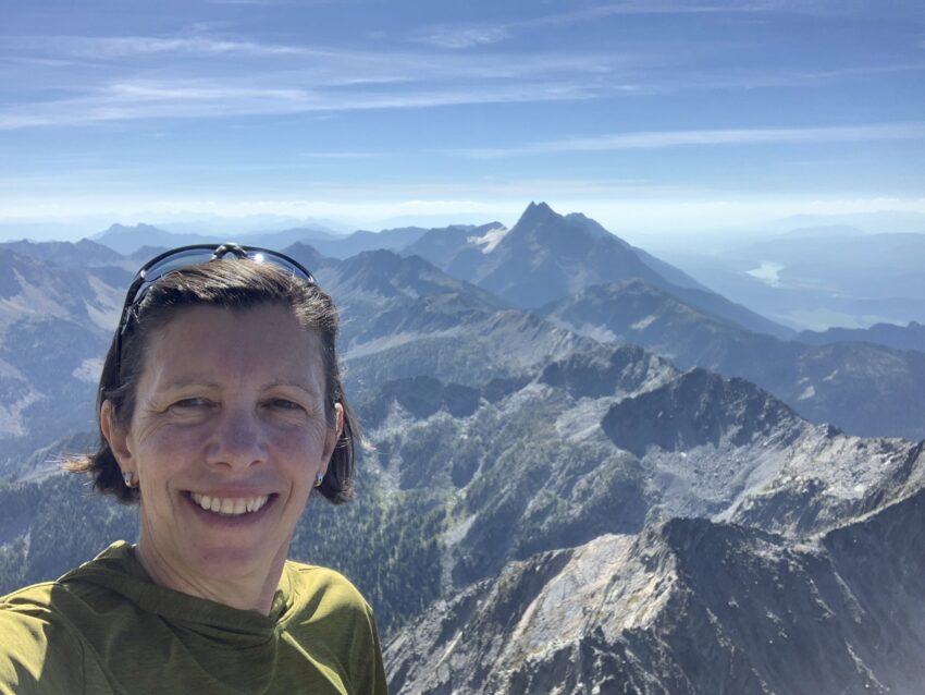
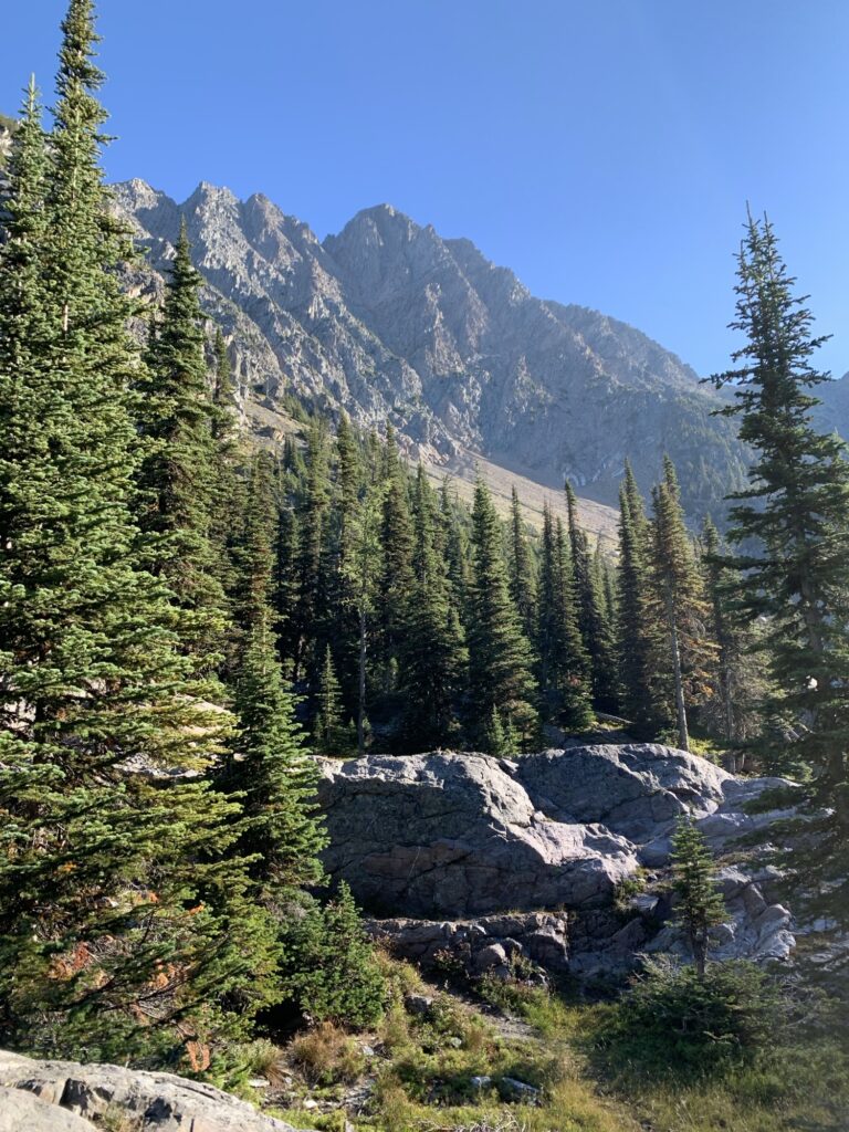
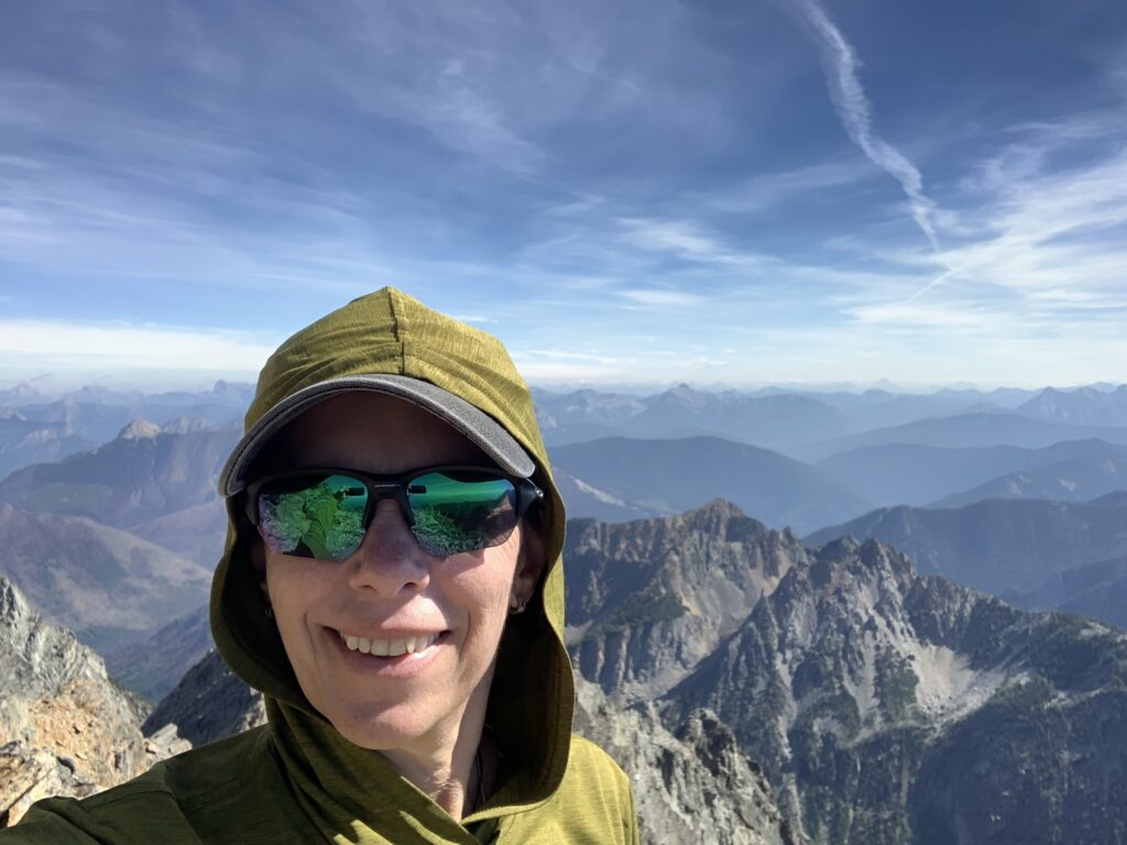
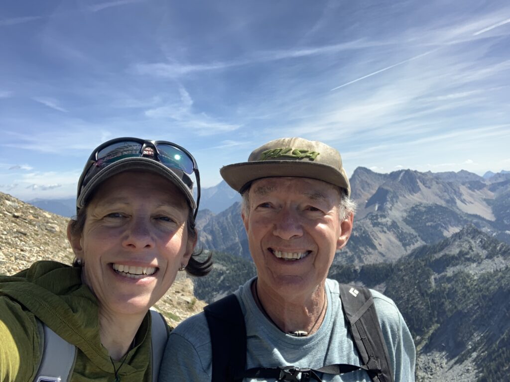
The highest peak we see in the distance every day around here is Fisher Peak. Since moving here I’ve wanted to attempt it and see the world from up there. The stars aligned and Pat, an accomplished local climber and hiker, agreed to climb it with me.
Including driving (about an hour) this was a 10 hour day. I was told it’s steep and requires scrambling and that was very true. The only flat few metres are half way up:
In 5km we climbed almost 1300m. Some stretches are solid ground, some loose scree, some sand, some big rocks. No trees in the higher parts, and hands are required to move up.
From the guidebook: “As you gain elevation, boulder slopes, loose talus, and scree span into the upper cirque. Scrambling is required, with potential exposure near the col and above, where the mountainsides descend below you, visually uninterrupted.”
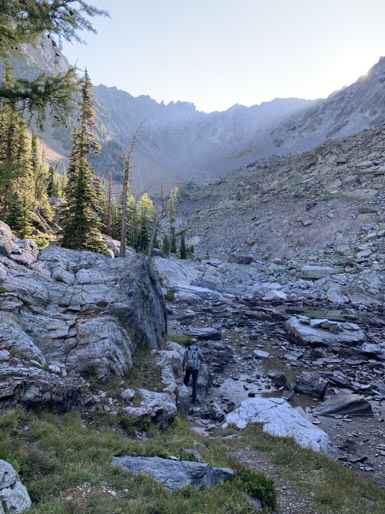
After the tarns, the slope gets steeper, treeless and loose. There is no one trail but you can see where people have climbed up before.
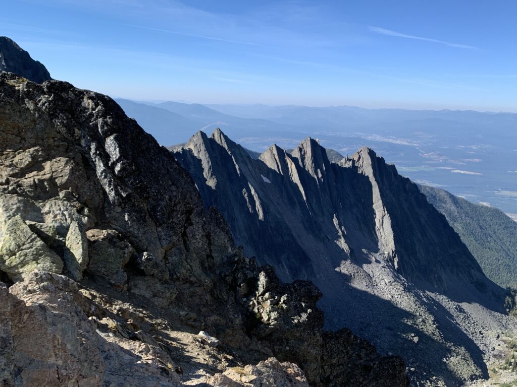
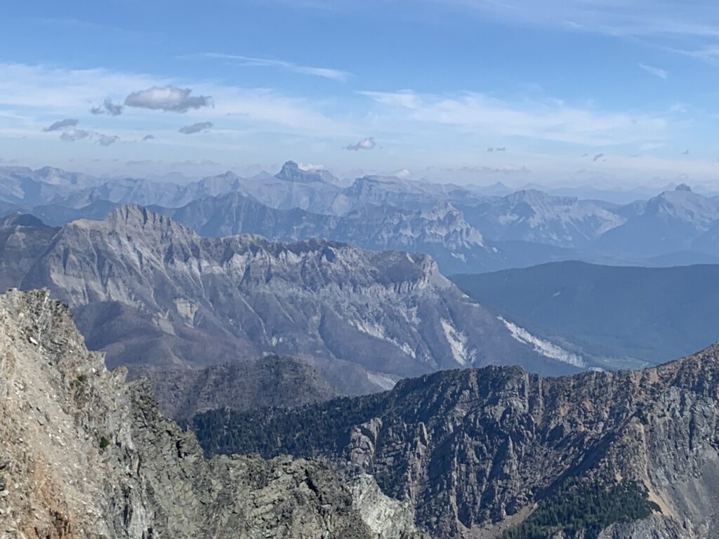
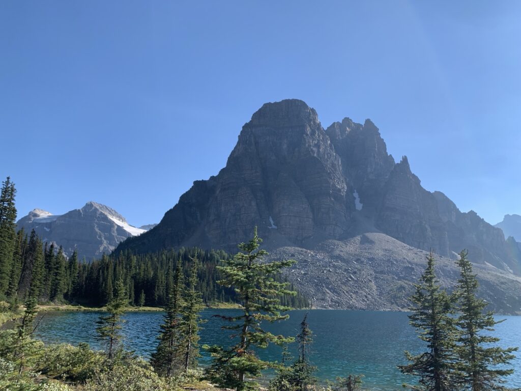
The first long distance views are from the col.
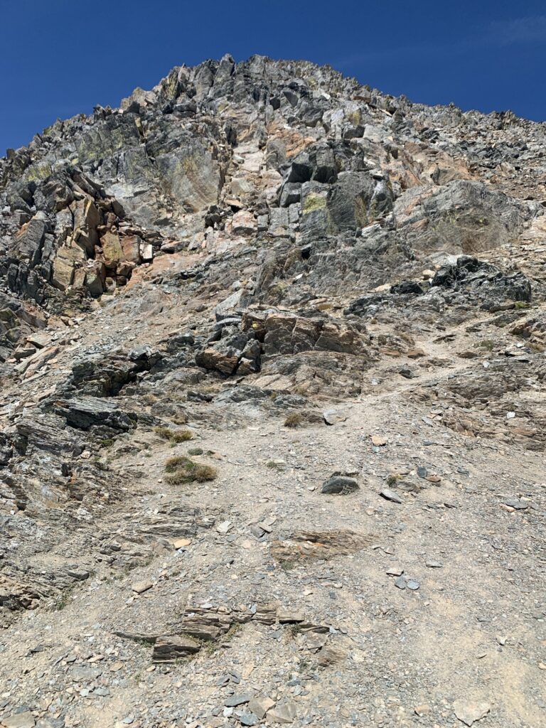
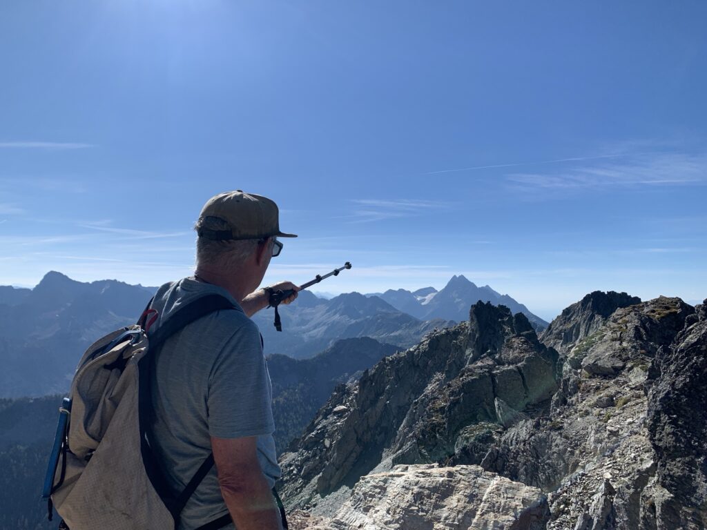
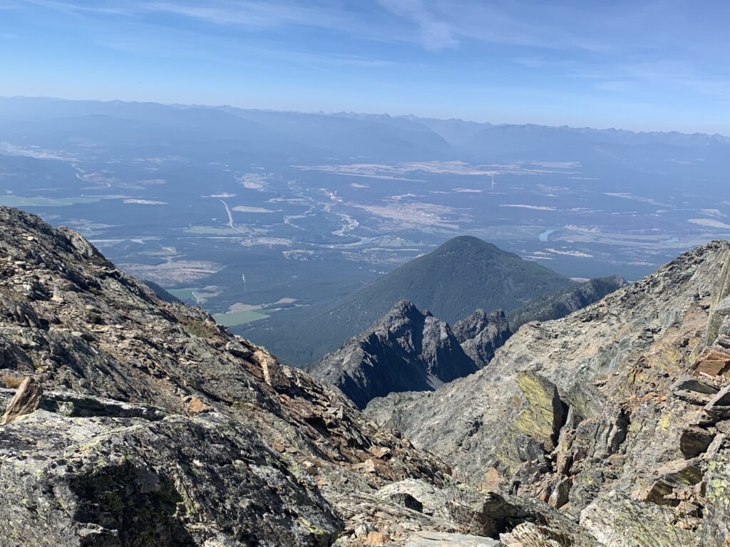
Then the more serious scrambling starts. Some of the bigger rocks are brittle so careful hand and foot placement is essential.
Often there are multiple paths you can take so we always assessed and chose the best option.
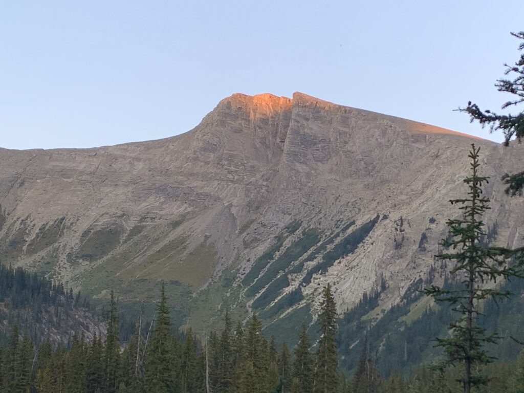
Just below the summit there are a few more metres of steep scrambling but with much more exposure so I decided to take my lunch break there.
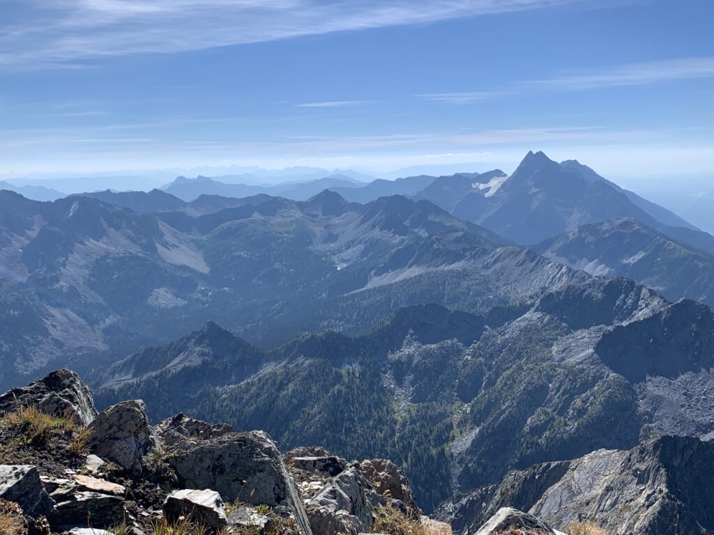
What a feeling to have those kind of views into the far distance! I felt very lucky to experience that.
The downhill is a bit faster but requires the same concentration. That’s where the quad muscles get a good workout! It took us 3 hours to get back to the car (3.5 hrs up).
Pat was a great guide and we made it up and down safely. It was a gorgeous sunny day, not too hot and no wind.
Even with plenty of recent hiking, my body was exhausted that evening. Nothing hurt but it was a major effort, and I was feeling my quads the next few days!
Mt Assiniboine Provincial Park – Sept 6-8
Day 1
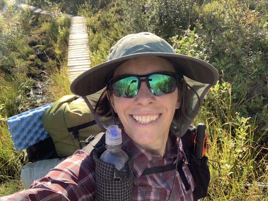
After completing some work in the morning, we were finally up and driving around 11:30am on Friday. Kevin was up for the hike that I had planned after studying the map for Assiniboine.
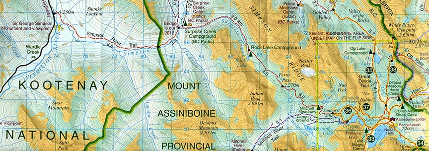
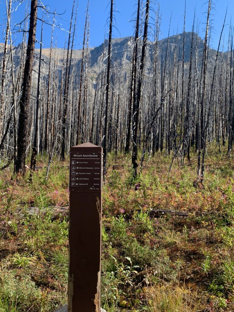
With some stops along the way, we didn’t start walking from Simpson Creek trailhead on Highway 93 until 2:30pm.
It’s very convenient as there is no rough gravel driving involved … the parking lot is in Kootenay National Park along the highway!
A few other cars were in the parking lot but all of those hikers only went out for a few minutes, then turned back. One trail runner passed us and came back while we were hiking east.
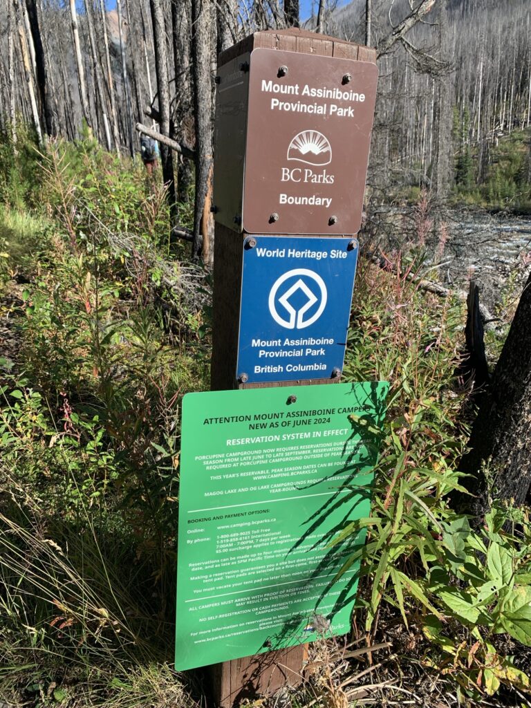
This BC access to the park is quiet and remote. Very few people use it, in stark contrast to the very busy and touristy east access from Sunshine Village. There you have helicopters flying to the lodge, campgrounds booked solid for the whole summer and many many hikers.
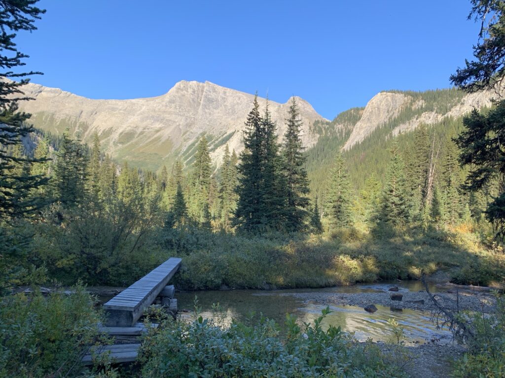
Coming from the west, it’s 12km to Surprise Creek camp, another 6km to Rock Lake and another 10km to Mitchell Meadows camp. From there my plan was to day-walk to the “core” area with the iconic Cerulean Lake, the view of Assiniboine, and then return to the quiet camps that require no reservations.
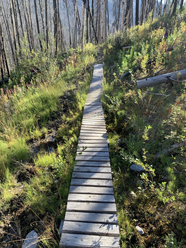
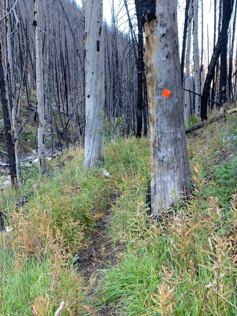
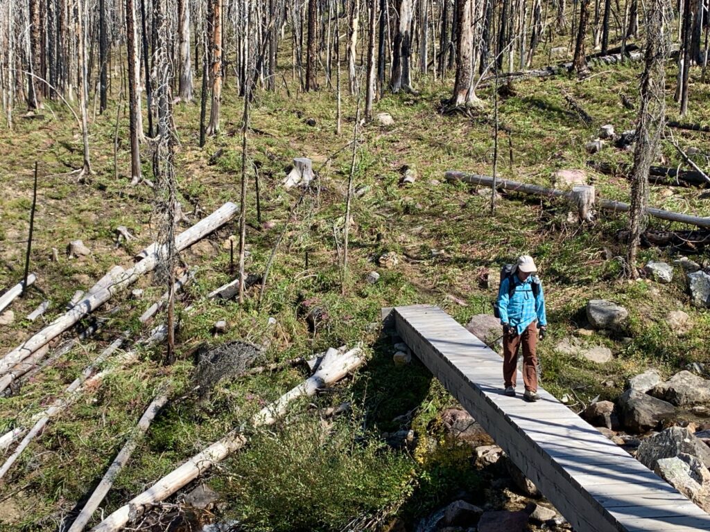
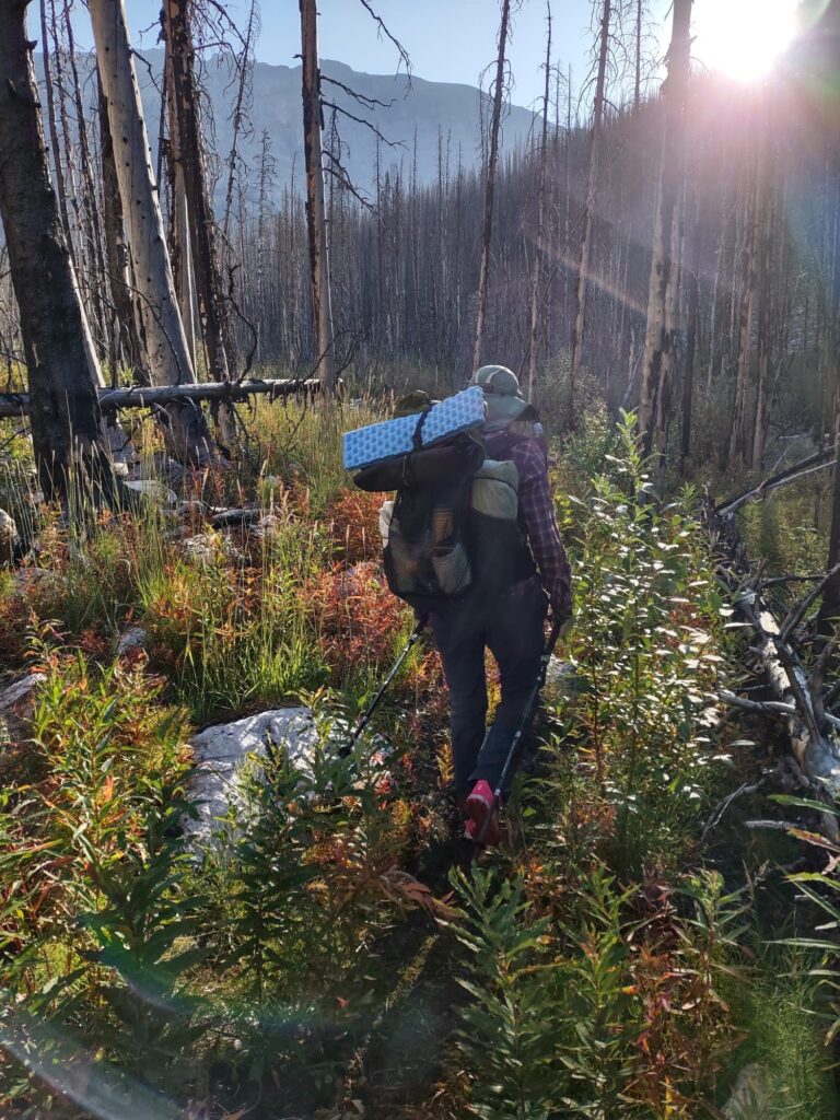
We hiked the 12km to get to Surprise Creek camp in 3 hours. It was mostly flat and undulating, along Simpson Creek. The trail is narrow and the bushes try to grow in from the side but it’s also obvious that it gets cleared of blowdowns at least once a year. We only had a few to climb over.
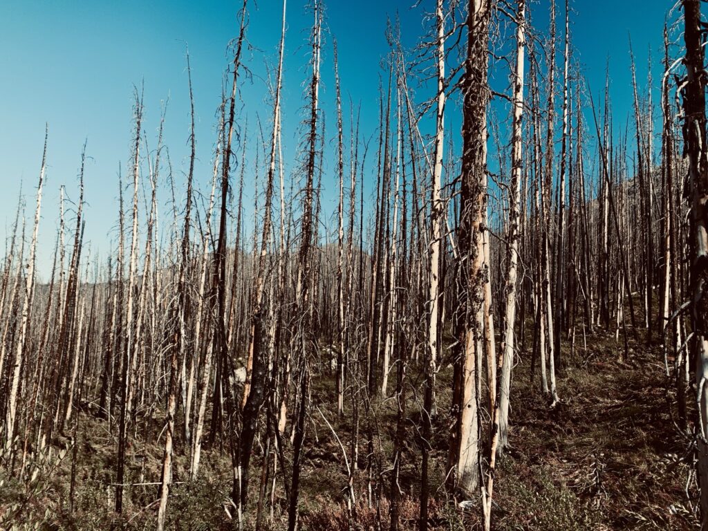
It is, however, a burn zone and I was surprised how hot it was when we started. Hour by hour the temperature got more comfortable and once we got to the campground, it was perfect for the sit-down dinner.
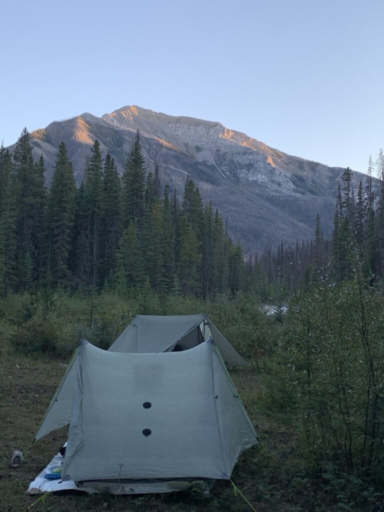
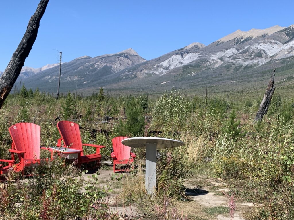
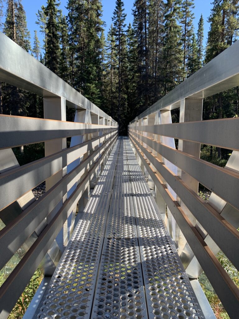
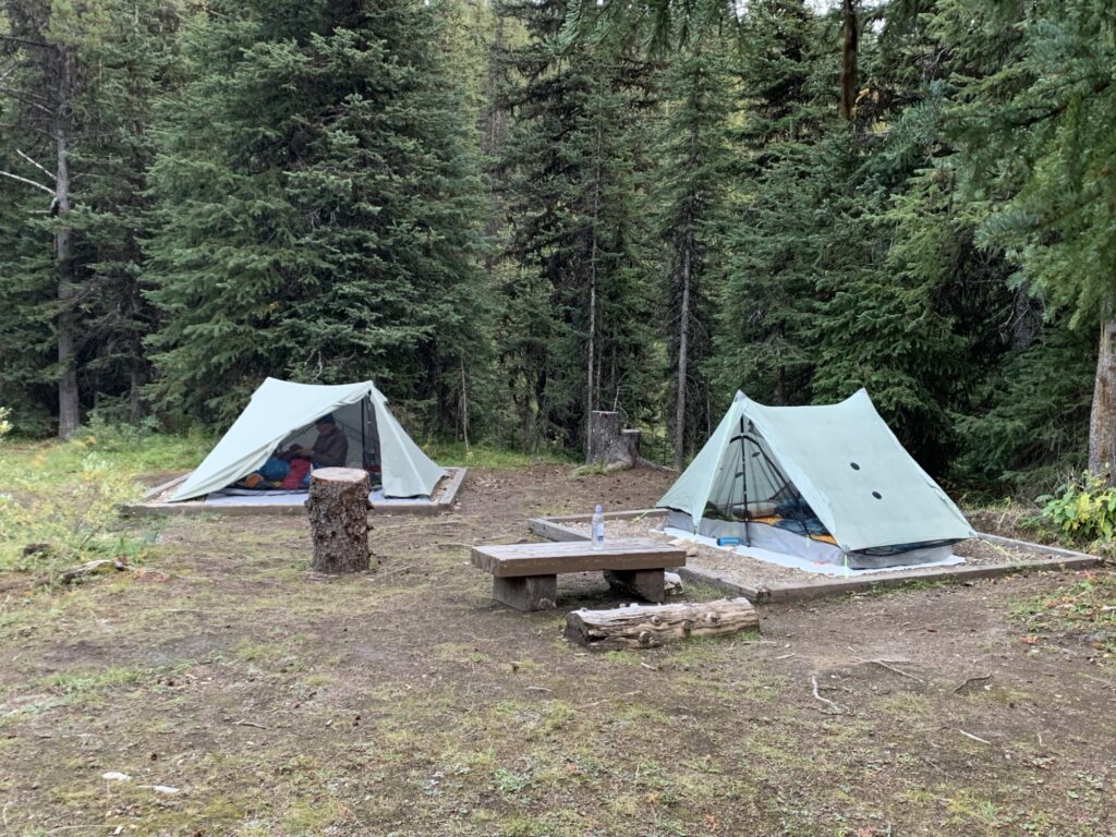
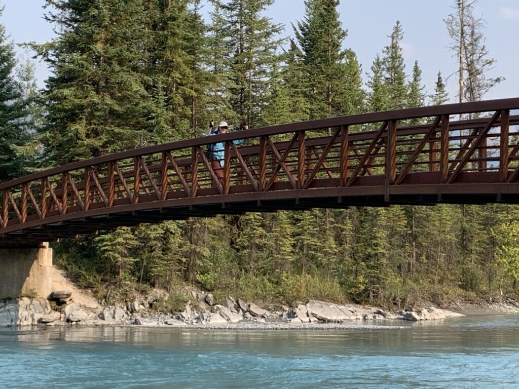
After crossing the new fancy bridge to Surprise Creek camp, we explored the cabin (okay to sleep inside and it looked pretty clean but tents are better!) and picked great tent sites in the meadow. Dinner was comfy in front of the cabin with steps and logs to sit on. The creek is just a few steps away as well.
The last light is fading and tomorrow will be a longer day so I’m falling asleep with the rushing of the river in my ears. I had the feeling Keyla was very excited about this adventure! ❤️
12km, 3:15 hrs, 330m up, 160m down.
Day 2
We left the Surprise Creek camp somewhat late at 8:30am … it seemed very dark at 6am, my usual wake up call! It also felt chilly in the meadow this morning so getting out of the quilt was double hard!
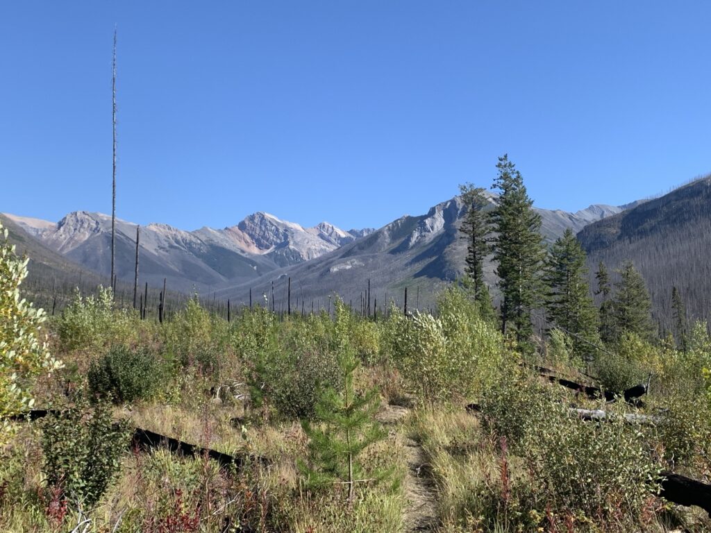
The trail started climbing after the mostly flat progression yesterday. We were still in the burn zone and would see the burned sticks for a while!
Nothing significant to report from the first 7km which brought us to Rock Lake Camp. It clearly got burned over but there is a new privy, bear boxes and tent pads.
Not an inspiring location with all the burn trees around (Surprise Creek has somehow been protected from that fire as there are lovely mature trees in that camp).
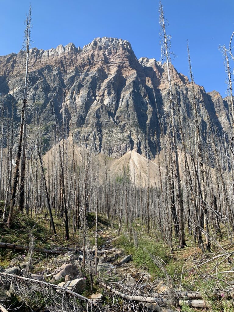
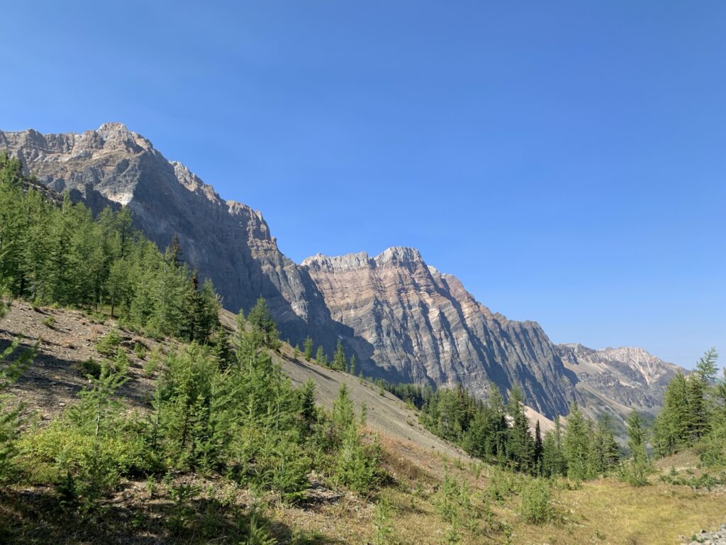
But slowly the views of the surrounding peaks became better and more open.
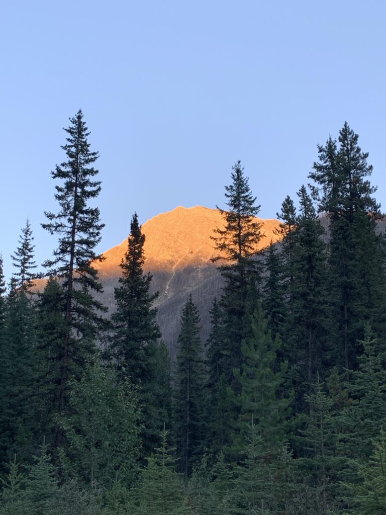
Then the trail climbed another 350m to Ferro Pass, and for the first time we hiked in trees and shade!
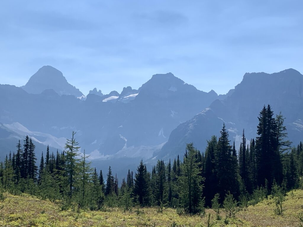
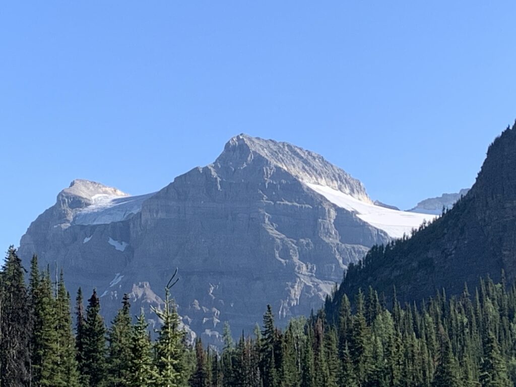
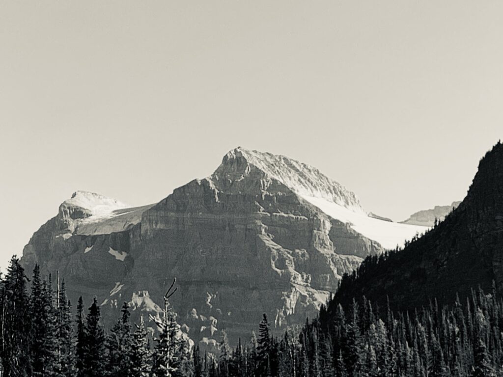
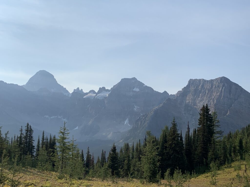
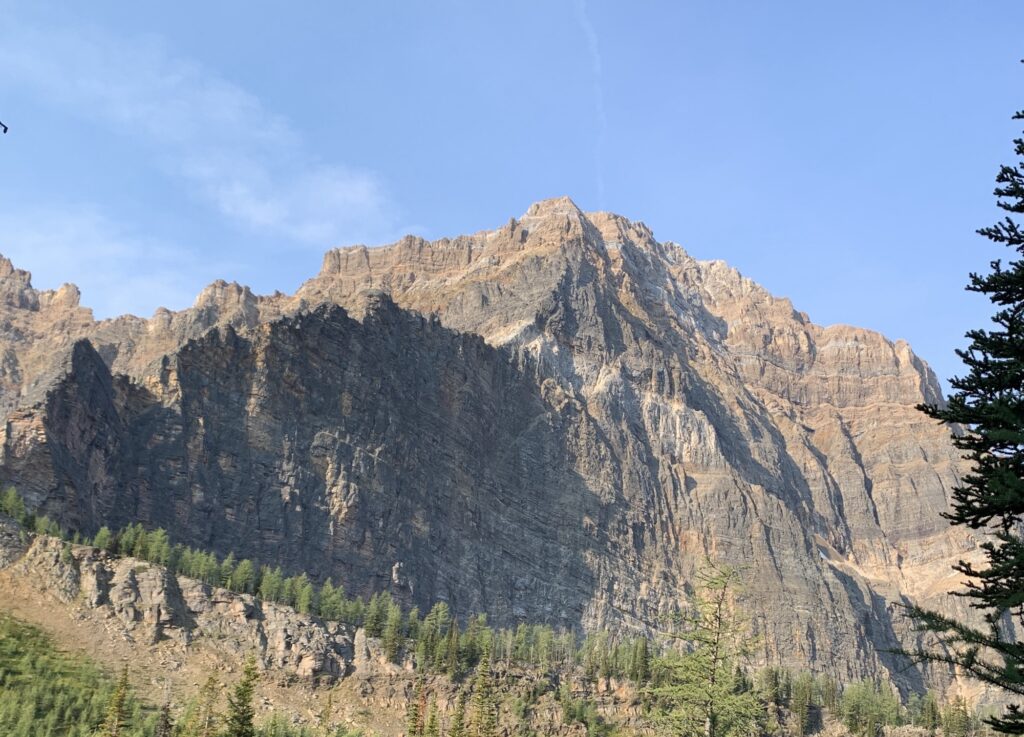
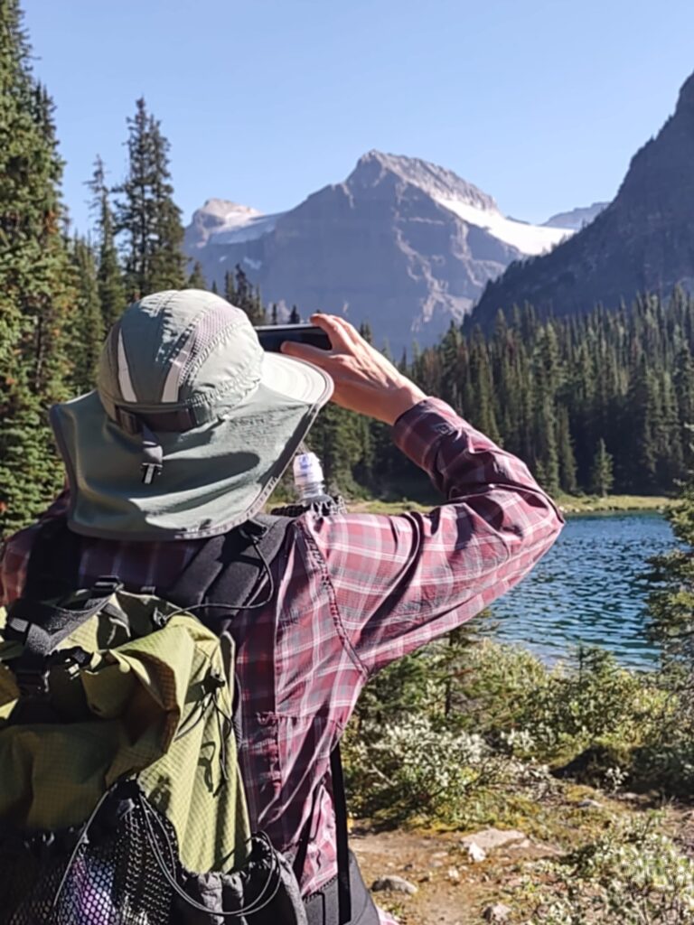
The view was spectacular, with a first glimpse of Mt. Assiniboine as well!
There were 3 backpacks left at the junction; the hikers probably climbed the ridge above. That was the only sign of human life we saw all day today!
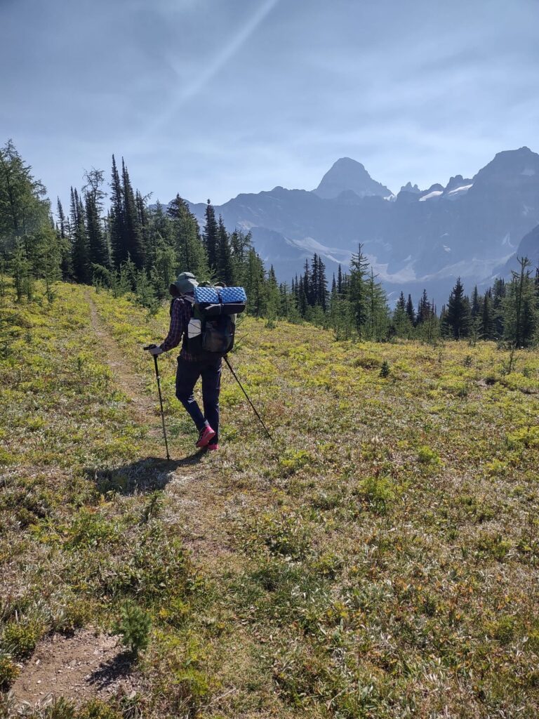
The last 4km to Mitchell Meadows camp were a blast … downhill and well maintained trail, I let ‘er rip!
I arrived here around 1:30pm, finishing around 16km from Surprise Creek.
But the plan was still to explore the core and see Cerulean Lake and Assiniboine from closer up.
So the afternoon hike added 9.5km to the total, with great views lakeside. Still no people … they are all crammed into Magog Lake camp! 🤣
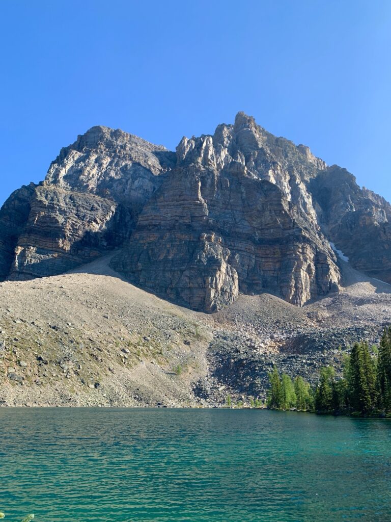
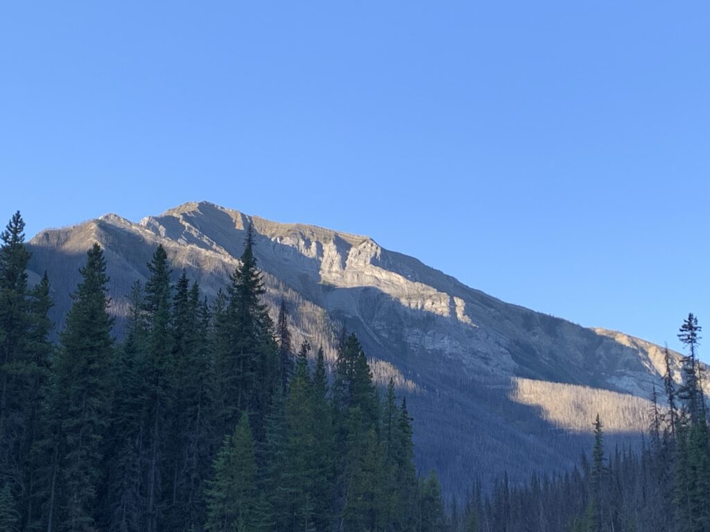
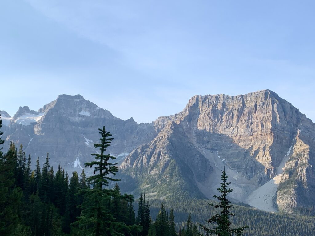
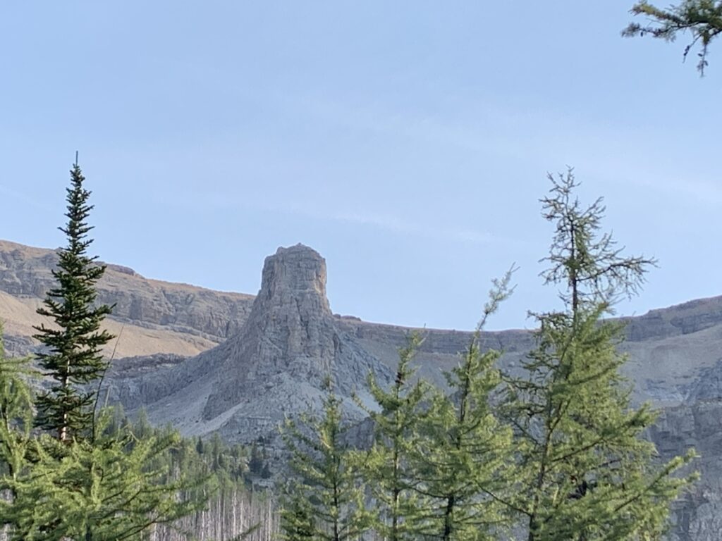
Assiniboine loomed in the distance, with great rock formations right at Cerulean Lake.
We had perfectly clear skies (much more hazy the next day) and felt lucky to be able to enjoy those views!
Quite possibly this was the last warm weekend of the summer/fall!
Mitchell Meadows is a nice enough camp, with 2 tent platforms, privy, bear box and plenty of benches. Still cushy! It might be another cool night, being higher than last night.
Mission accomplished! Totals for the day: 25.2km, 7:45hrs, 1200m up and 590m down.
Day 3
Originally I had planned to split the hike back into two days. 16km to Surprise Creek, 12km to the highway. However the call of a shower, food and a bed is always strong! Good on Kevin for entertaining the thought and agreeing to a long hard day of hiking!
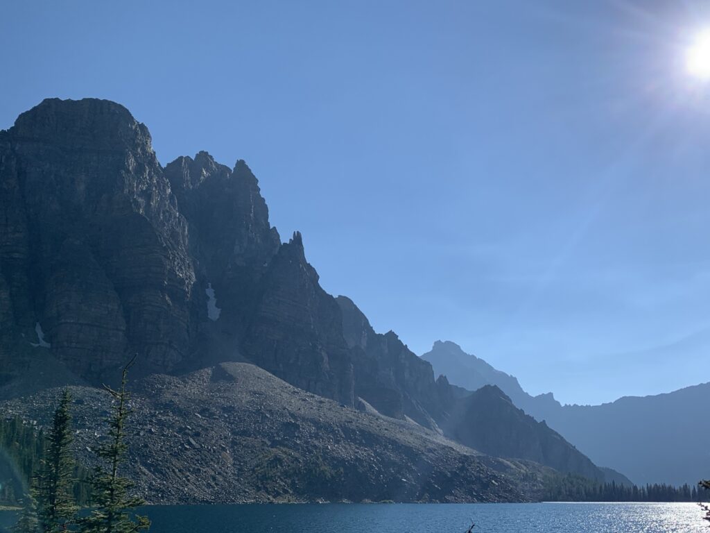
From the camp at Mitchell Meadows to Ferro Pass it’s a 300m climb in 4km. I waited on top and enjoyed a last look at Assiniboine.
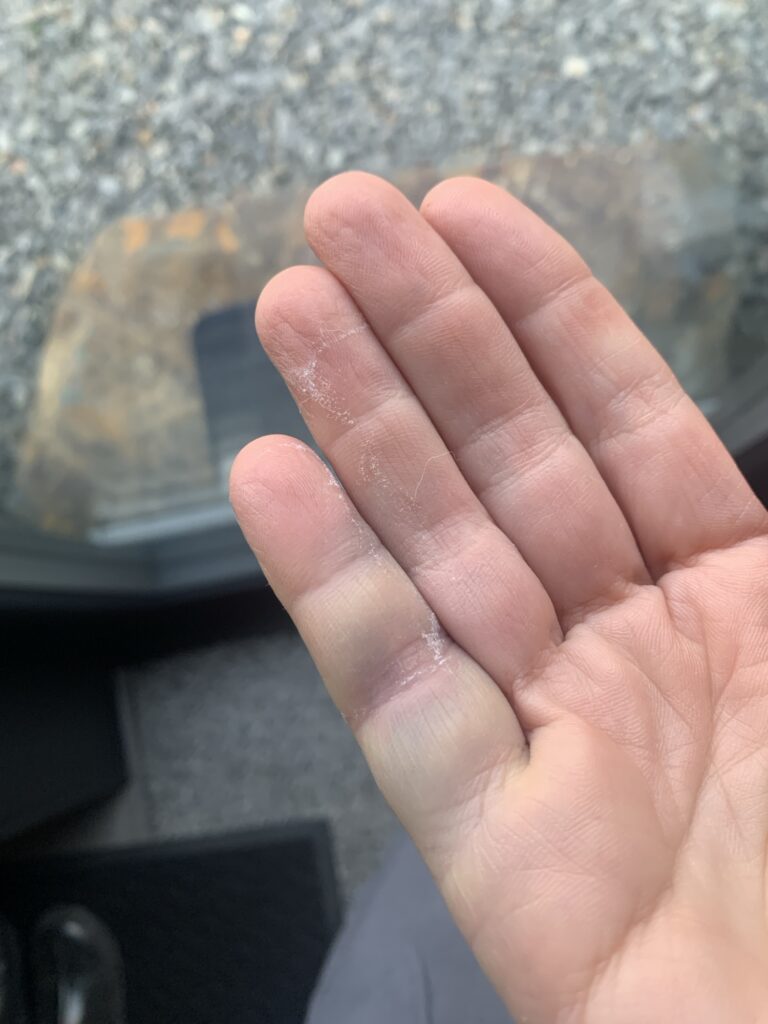
Then we had 12km of downhill, again in the burned area. We made good time but it’s not always easy with loose rocks and sand (my finger tells the story of a simple slip and catching myself).
Today we met the first people on trail: a couple from Oregon hiking to the lodge, a couple from West Vancouver and a single guy trying to figure out where to go. The reservation system that doesn’t often have any campsites available for the core area restricts a lot of plans.
It took about 5 hours of solid hiking to get to Surprise Creek where we stopped for lunch. The big ups and downs were done by them. However, the last 12km, while much flatter, are not easy either.
Overall that day included 28km of hiking in 8hrs, 453m up and 1114m down.
We both did well but were really tired when starting the 2hr drive home. But the adventure was successfully completed! I was hungry and tired but my muscles weren’t sore like after Fisher Peak!
Luckily my hiking kit is so dialled in now that everything just works. I’m happy to have checked off a few of my planned challenges this summer!! Thanks for following along; please leave a comment!!
The photos are beautiful! Well done Biggi!
Thanks Kevin! So many great adventures to be had around us here!!
Fantastic adventures!🤩. Fisher is a major achievement! 💪 You hiked on beautiful days with spectacular views. Love the pictures! 🏔️⛰️
The finger looks gruesome but should heal quickly for xc skiing! Garmin tracking is a great addition to your blog!! Congratulations!👏
Thanks 😍 I was lucky to have clear skies all around! ☀️
What great rewards for those long hard days. The finger looks sore. Your hiking friends sound very experienced too. Nice
Thanks Jan! So much to explore!!
Biggi, you are a beast of a hiker. Totally inspirational. Almost want to try this myself. If only I wasn’t such a water person. Keep it up!
Thanks Ken! You should try it sometime! I’m not a paddling fan but can see the appeal! I like being on my feet 👣 🤣
Thank you for sharing. Hope to get out this fall. Current priorities much less exciting.
Yes understood! Hope you get to enjoy the fall outside after all is done! 🍂
Well done Biggster!
Beautiful pics!
🌝
Thanks Geoffrey 💕
Incredible pictures! The fresh mountain air, what a beautiful experience you had!
Thank you for sharing!! 💕🙏🏼
This is huge !!—Amazing adventure
Thanks for this Biggi
Thank you Joycee 😍
Glad you got to enjoy this over dinner! Thank you for reading about my adventures 😁